← Places that changed the most
Rouse Hill, then and now
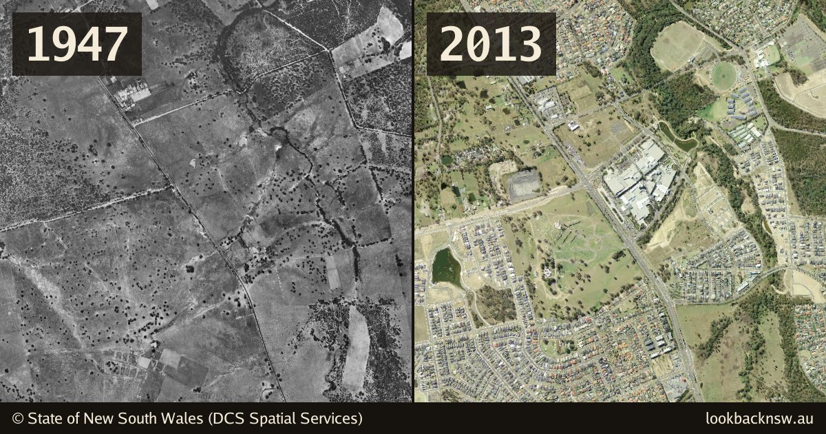
Paddocks and a creek in 1947, a town centre and housing estates by 2013.
1947
In 1947 this is farmland: fenced paddocks, scattered gum trees and a creek winding through, with Windsor Road running across the frame and a few farm buildings beside it.
2013
By 2013 Rouse Hill Town Centre sits beside the road, and housing estates fill most of the paddocks on both sides. The creek is still there, kept as a strip of bush.